Starling Intelligence
Starling Intelligence is a stand-alone general-purpose road-user detection system based on image processing and proprietary algorithms. It delivers comprehensive data and information on the numbers, movements and interactions of these users in road and pavement spaces.
Starling Intelligence provides real-time and historical data and information to allow for flow modelling and real-time monitoring with the specific focus on mitigating the safety risks and congestion.

Problem Use Cases
Operators of the road and street networks need to validate and evaluate the usage of their permanent and temporary networks, including cycle paths:
a detailed understanding of all user's behaviour and activity using the network;
detailed behaviour analysis for stakeholder management and community engagement
Starling Intelligence can supply:
Highly accurate data and analysis of vehicle and pedestrian behaviour and movements, danger scenarios - near misses and collisions;
Historic aggregations of this data to create a detailed assessment for transport strategy modelling;
Anonymous data and information about the real-time use of a location.
Detection and Collection
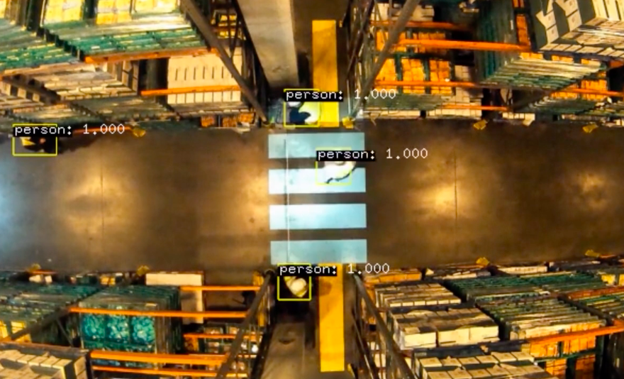
Starling Intelligence can deliver an unprecedented level of detailed data of the type of users, how they use the available space and interact with other road users generated by our Artificial Intelligence (AI). Starling’s AI classifies road users, analyzes their path, speed and behaviour. Starling’s configurable behaviour analysis is highly versatile and adaptable to different scenarios and events. The count could be very simple or specific to the location and existing behaviour.
Below are some examples of metrics that we can provide:
Advance counting
Density by road user types
Direction and flow of movement
Average and maximum speed
Path analysis - desire lines and usage heat maps
Behavioural analysis
Predicts possible accidents or near-misses
Generates danger quotients
Crosser classification - confident, hesitant, denied, irrelevant.
Vehicle classification - vehicles that give-way, that do not give-way
Vehicle stopping distance - distance stopped from a given point, i.e. the distance between vehicle position and the edge of a crossing.

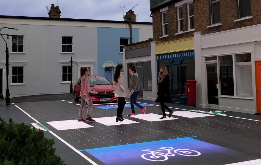
Behavioural analysis in action
How to use Starling Intelligence

Real-time local analysis
Using a live feed from a pre-installed CCTV network
Using a portable powered Starling CCTV unit located at a site
Using a permanent Starling CCTV unit attached to a vertical pole
Historical analysis
4. Using supplied video files from existing CCTV
How we deliver analysis to customers
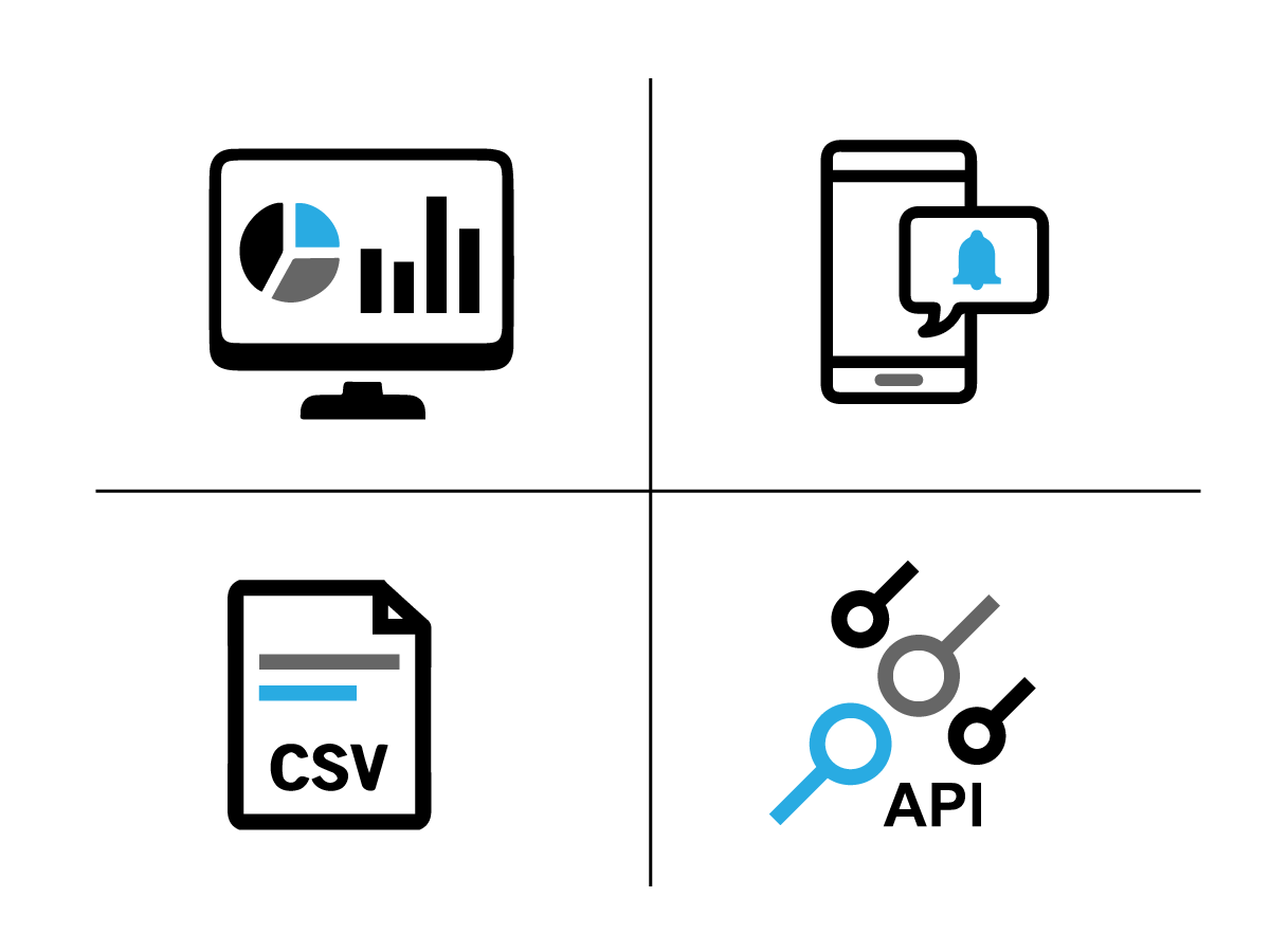
To get access to the data and analysis:
Render data in customisable visualisations
Over different time frame - the last five minutes or last five weeks
Customizable visualisation: displayed as pie, line or bar charts.
Set triggers or notifications when certain events happen
Send SMS / email / Slack Alert to local staff when there are too many cyclists on the pavement.
Download the raw data for further analysis.
Data access via API
HTTP endpoint for data request
Data pushed to the customer's data platforms.
Where is Starling Intelligence being used?
In Autumn 2021 Starling Intelligence is being used to undertake a behavioural analysis as part of the assessment of new crossing infrastructure being installed in Portsmouth.
In 2021 and 2022, Starling Intelligence be used to provide behavioural surveys at crossings and junctions across France.
Deployments